National Park Reservations is a reservation service providing lodging and activity reservations. National Park Reservations is not an authorized concessionaire of any National Park nor are we in any way affiliated with the National Park Service of the Federal Government. For this service, National Park Reservations charges a ten percent non-refundable reservation fee based on the total dollar amount of reservations made.
National Park Reservations provides the ability for its customers to make reservations through a toll-free telephone number or by submitting an online request form. By using National Park Reservations, the customer authorizes National Park Reservations to charge their credit card. This reservation fee will be billed separately to your credit card and will be billed under the memo “National Park Reservations”.
Make Your Reservations Today!.
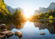
Both a national park & World Heritage site, Yosemite is celebrated for it's spectacular cliffs, waterfalls, streams, lakes and Giant Sequoia groves.
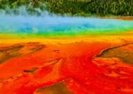
America's first playground, Yellowstone is famous for its boundless wildlife and its many geothermal features.
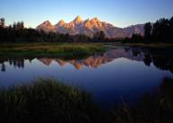
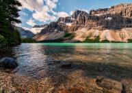
Grand Teton lets the imagination run wild with its pristine lakes, two hundred miles of trails, wildlife and the peaceful serenity of the Snake River.
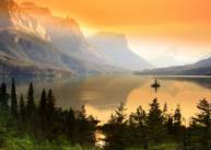
Montana's breathtaking Glacier Park encompasses two mountain ranges with active glaciers, over 130 lakes, and more than 700 miles of trails.
Often considered one of the Seven Natural Wonders of the World, the Grand Canyon is an inspiring color-filled canyon up to 18 miles wide and a mile deep.
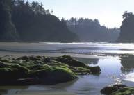
Packaged like three parks in one, Olympic offers an assortment of temperate rainforest, breathtaking mountain range, Pacific coastline and lush forest.
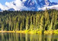
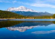
Mount Rainier National Park is home to one of the tallest peaks in the US Mount Rainier, more than 142 sq. miles of old-growth forests, and 26 named glaciers!
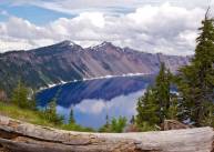
Despite its violent volcanic history, Crater Lake displays an incomparable, peaceful beauty of skyhigh cliffs, beautiful islands, and a lake so intensely blue its mesmerizing.
Sequoia contiguous with Kings Canyon, is a landscape famous for its vast caverns, jagged foothills and its giant sequoia trees.
Big Bend displays majestic sunsets, deep canyons and is the largest protected area of the Chihuahuan Desert.
With its rolling hills, beautiful autumn colors, cascading waterfalls and eye-catching vistas, Shenandoah exemplifies the serenity of creation.
Come explore granite peaks and bike the more than 50 miles of historic carriage trails.
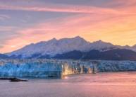
Encompassing more the six million acres of wild land, Denali is home to Denali, the tallest peak in North America.
Kenai Fjords, home to numerous glaciers and fjords, is located on the Kenai Peninsula, near the town of Seward. A fjord is a narrow, long, deep inlet of the sea between high cliffs.
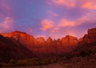
Zion is recognized for its sandstone cliffs, slot canyons, brilliant colors and it's unique plant and animal life.
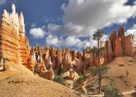
Renowned for its immense collection of colorful geological structures, otherwise called hoodoos, Bryce is like no other place on the planet.
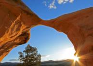
Arches is a colorful landscape recognized for preserving over 2,000 natural sandstone arches.
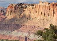
The beautiful Capitol Reef National Park in Utah is a hidden treasure filled with canyons, cliffs, bridges, domes and the Waterpocket Fold, a geologic wrinkle on earth.
Grand Staircase encompasses a territory sampler of plateaus, mesas, canyons, pinnacles and multicolored cliffs.
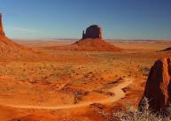
Monument Valley displays a cluster of sandstone masterpieces that climb to heights of 400 to 1,000 feet.
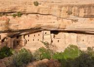
Mesa Verde contains over 600 cliff dwellings of the Ancestral Pueblo people, including the Cliff Palace which is thought to be the largest cliff dwelling in North America.
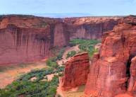
Nestled within the boundaries of the Navajo Nation, Canyon De Chelly protects the ruins of the early indigenous tribes.
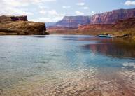
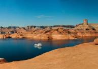
Lake Powell is America's second largest man-made lake and a popular summer playground destination.
Despite its grim name Death Valley is a below-sea-level basin that is home to a plethora of plant and animal species that have learned to adapt.
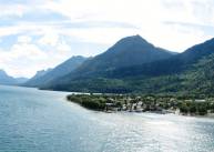
Canada's Waterton Lakes combines stunning views of the prairie, jagged mountain peaks, breathtaking lakes and freshwater wetlands ecosystems.
An impressive medley of mountainous terrain, numerous glaciers and ice fields, clear lakes and dense forests.
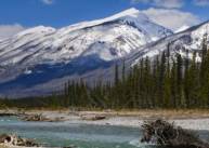
Jasper is the largest National Park in Canada and includes the glaciers of the Columbia Icefield and an immense amount of wildlife.
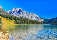
Yoho National Park was created on October 10, 1886. The park is located in the Rocky Mountains on the western slope of the Continental Divide of the Americas.
Kootenay National Park is known for its crystal blue mountain rivers and the intense hot springs.
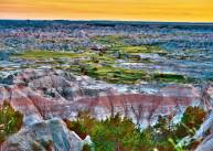
The Badlands boast more than 240,000 acres protecting prairie and some of the world's richest fossil beds.
Mount Rushmore brings visitors face-to-face with the prominent faces of four US presidents, who helped shape this country.
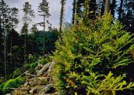
Recognized for the most massive tree species on earth, Redwoods also preserves extensive grasslands, rivers and streams and an unforgettable coastline!
A combination of two deserts, Joshua Tree is known for fascinating plant life and rock formations.
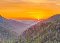
As the most visited national park in the country, the Great Smoky Mountains National Park boasts the most impressive collection of Appalachian historic landmarks.
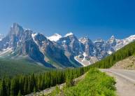
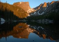
Rocky Mountain features mind-blowing mountaintops and lakes, a variety of wildlife and over 300 miles of hiking trails.
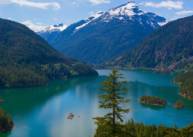
With rugged peaks & more than 300 glaciers, North Cascades is acclaimed for the abundant waterfalls that cascade into deep valleys.
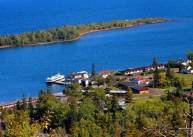
Isle Royale is an isolated wilderness island perfect for all those seeking unparalleled beauty, solitude and adventure.
Lake Tahoe is home to world-class ski resorts, majestic mountains and many summer outdoor recreational activities.